Montville Township Historical Society
Unlocking History, Embracing Community
History
The Morris Canal, constructed between 1825 and 1831, was a technological innovation for its time. It traveled 102 miles from Phillipsburg to Jersey City and had a cumulative rise and fall of 1,674 feet. It used a combination of traditional locks and innovative inclined planes to overcome the largest elevation changes. This section of the canal does not contain any inclined planes or locks, but the prism and toe path remain partially intact today. Although traffic on the Morris Canal had diminished by the 1880s due to an increase in the reliance upon the railroad to transport goods between the coal mines in northeastern Pennsylvania; the forges, mines and foundries of northwest New Jersey; and the industrial plans in northeast New Jersey, the canal was not officially abandoned until 1924 Upon its abandonment, the State of New Jersey systematically drained the canal and dismantled many of the buildings and structures associated with it. Much of what was the canal route is either in ruin, has been removed from the landscape due to development, or is in some other manner unrecognizable as a remnant of the canal.

The Morris Canal
Within Montville - 2026
The Morris Canal begins near the Boonton border where the Inclined Plane 8 and 9 East are located. Rte 287 now covers a portion of the Inclined Plane 8 East. Portions of this area can be accessed via Emry Lane. This area had been cleared and cleaned in the past, and after time, needs some revisiting to bring it back. There are two interpretive historical panels in this area.
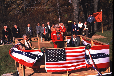
Picture courtesy of the Canal Society of NJ
From the end of Emry Lane, the Canal crossed what is today the modern Rte 202 and continued behind the Canal House (across form the Van Riper building). Remnants of the Inclined Plane 9 East can still be seen behind the Canal House. At one time, there were 2 other buildings located in what is today, the parking lot for the Canal House. These 2 buildings would have served the Morris Canal at that time.
Picture courtesy of the Canal Society of NJ
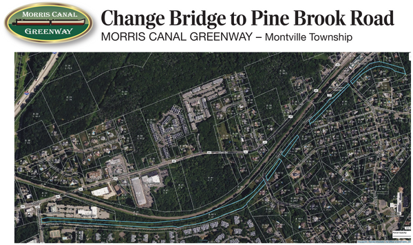
The Morris Canal then follows parallel to rte 202 behind the row of houses up against the road, across from Asa Street down to Valhalla Road. It crosses under rte 202 and runs parallel to Valhalla Road for about 300 feet and then turns right, back towards rte 287. Rte 287 cuts across. You would need to go under rte 287 on rte 202. Unfortunately, this section, now the Diversified Warehouse and Office complex has obliterated any remains of the Canal up to Changebridge road.
Once you cross Changebridge road, the next 1.7 miles is probably the best preserved sections of the canal. Eventually, we hope to install a walking trail along this full length.
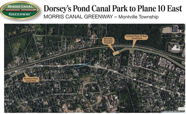
Finally, the Morris Canal then parallel rte 202 (mostly private land in this section) before crossing over a few 100 feet before the Lincoln Park border. Just before the gas station. In the Montville section along the way, you can stop at Dorsey's pond where several historic markers tell more of the story.
Once the crossover occurs, the Canal runs behind the gas station and down the hill through several private properties until you come to Incline Plane 10 East. Some remnants of this section are still intact, but most are buried.
This Plane descends into Lincoln Park and is now a linear park.


Restoration and Celebration
Beginning in 1987 and completing in 1988, a section of the Morris Canal was partially restored as part of the stormwater management on Macculloch Drive for the Changebridge at Montville Condominium complex. It was rededicated in the Spring of 1988.


Celebrating the Morris Canal
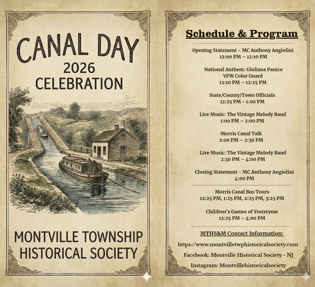
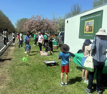
Canal Day at Montville - 2026